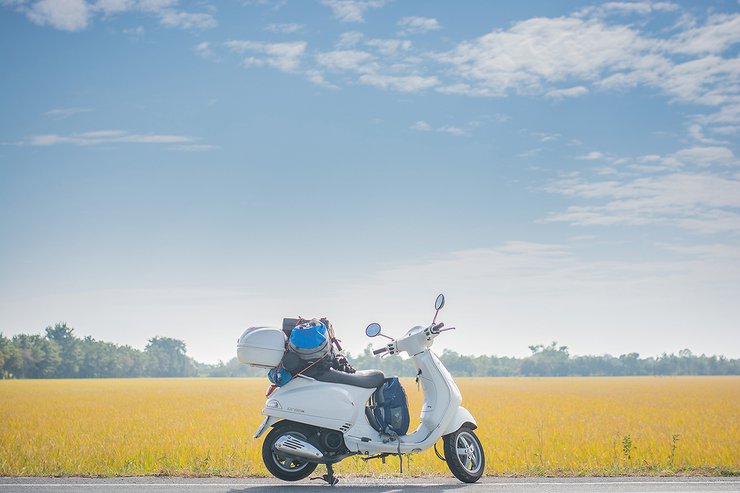
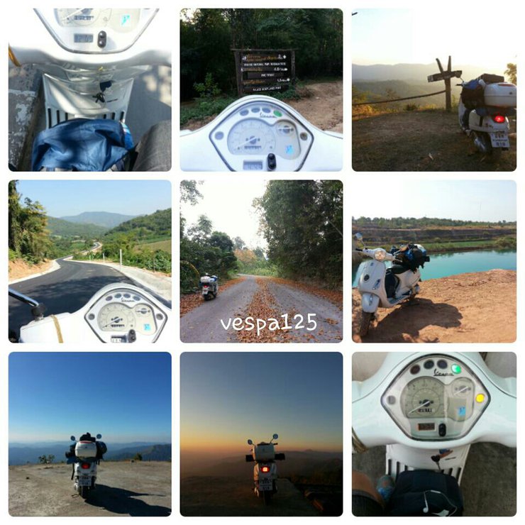
Embark on a new adventure covering 1,887 km with Vespa125ie (Bangkok - Phu Toei National Park 1-3 - Mae Wong National Park - Kamphaeng Phet - Mon Bridge - Khao Chang Phuak - Bangkok).
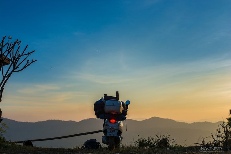
Hello, fellow Thais who are reading this. This is my first review, so please forgive me if I make any mistakes and feel free to give me some advice. The story is that I just wanted to ride my motorcycle around. The motorcycle is a Vespa 125ie, the same one in this picture. This trip covered a total of 1,887 km. (I started my journey from Bangkok on December 25, 2014 and returned to Bangkok on January 7, 2015.) (On December 27, 2014 - December 29, 2014, I went to Khao Kho with friends, and on December 30, 2014 - January 3, 2015, I painted the fence at my new house, so my motorcycle was parked at home, which means I had about 7 days left.) If you're ready, let's get started. (Hold on tight, I'm going fast ^^)

December 25, 2014
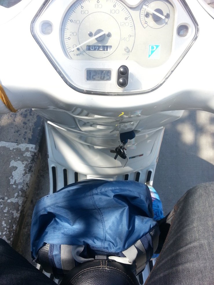
Around 12:00 p.m., I started my journey near Techno Bangmod. However, I almost forgot to take a picture.

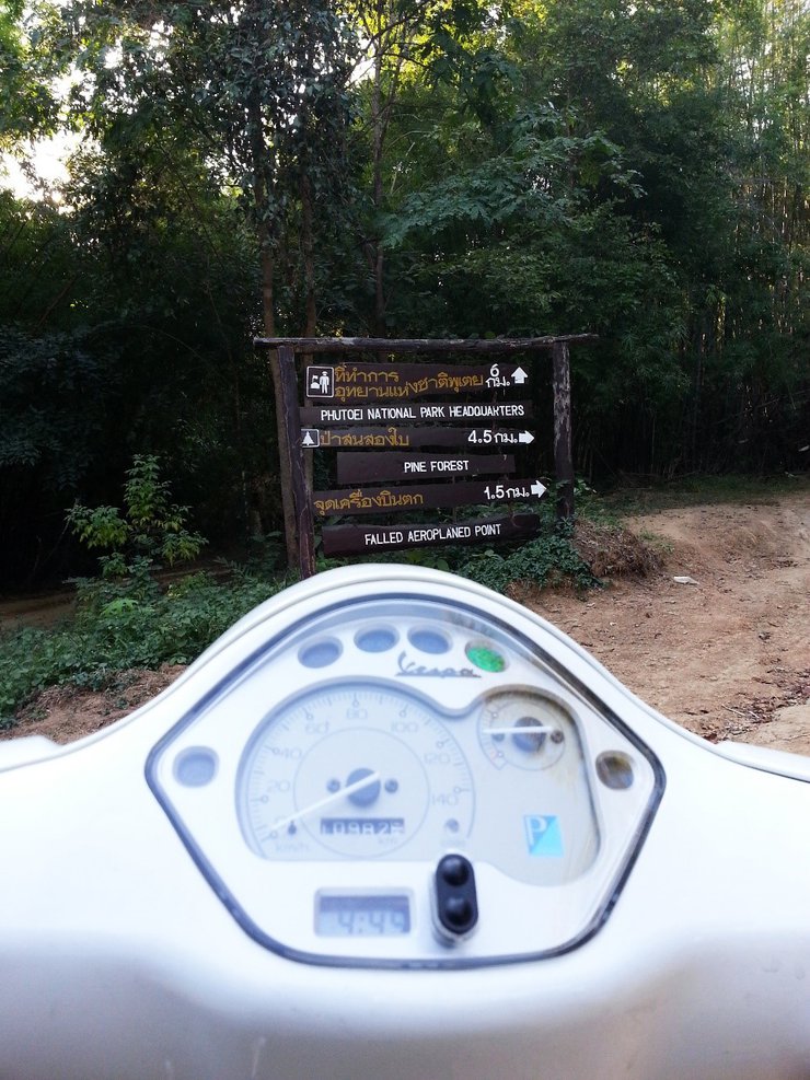
At that moment, I opened my GPS to see which way to go back. I then saw Phutoey National Park in Suphan Buri and set a goal to sleep there that night. I rode along the route. Not long after that, I saw the sign! (Why am I so happy? It's still a long way to go.)

It was another scorching day. We occasionally stopped to rest under the shade of trees and admire the rice fields.

Shortly after driving on, we came across a field of golden rice paddies. The sight reminded me of a particular advertisement.

Boom! It turned into cocoa crunch... (Sometimes we ride, focusing only on the destination, forgetting to look at the things along the way. Sometimes, the things along the way might be more beautiful than our destination.)
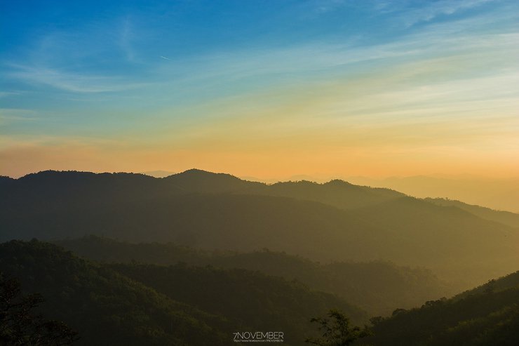
The journey was filled with breathtaking scenery. After a brief rest, I glanced at my watch and realized time was slipping away. I hurried onward, fearing that darkness would descend upon Phuteuy before I could reach the summit and be denied entry.
Is there anything else I can help you with?
We have just begun, please don't get bored. We will continue tomorrow. Let's continue from last night...
"After a while, but not too long, I arrived at Dan Chang District. I asked the person filling up the gas tank…"
Me: Excuse me, how do I get to Phu Toei National Park from here?
Gas station attendant: Just go straight this way and you'll see the sign.
"Wow, Cherry, you're a lifesaver! (But don't get any ideas, I'm not cheating on you.) It's okay if you can't make it, I'll just turn on GPS and keep going."
I then saw a sign for Phu Toei National Park. As I drove on, I saw a sign that said "Park Ranger Unit 1". I immediately asked the officer.
Me: Can we go up a bit higher? The view here isn't very nice.
Officer: Okay, then you can try riding this way for a while, but will your car make it?
He: Why, brother? Is the road bad?
Officer: "It's a dirt road, young man. Drive carefully."
"Me: Thank you very much, brother. (I rushed off on my motorbike then, as it was starting to get dark and the air was cool.)"
After driving for a while, I came across a fork in the road and a signpost…

Two-Leaf Pine Forest and the Plane Crash Site
I chose to only visit the plane crash site. When I arrived, I paid my respects at the shrine and then quickly turned around and headed back to the post office. (At that moment, I felt a strange fear. I got goosebumps, and it felt empty, dark, cold, and dizzying. I can't explain it.) Then I rode on to the next checkpoint. I want to tell everyone that I'm starting to get scared, but what can I do? Fear is just something we create ourselves. Let's keep going, brothers and sisters. As I continued riding along the path, I saw signs indicating the distance remaining.

After a long ride, I realized I still had 2 kilometers to go. I hurried and rode standing up, fearing it would get dark soon. At one point, the steep downhill road curved sharply, and the loose dirt caused my bike to skid. I quickly lifted the bike and continued riding. Soon, I reached my destination.

I've finally arrived! But wait, there's a sign that says "Forest Management Unit 3 (Ban Pong)". I thought to myself, "Wow, how many units are there?" Then I went to ask the officer.
Me: How many units are there in total, brother?
Officer: These 3 units are the 3rd unit, but they are at Ban Pong. Then there will be Ta Phin Ki again. (I thought to myself, since I'm already here, I have to go all the way.)
Me: Where did the 3rd unit go, brother? Will I be able to catch up with them?
Officer: He looked at my car and said, "If your heart is set on it, you'll make it in time (wow, Ronaldo!)." Then he told me to go down this way and turn right, and then just keep going straight. There will be signs to show you the way to…
As I continued riding, I came across a three-way intersection. I asked the locals for directions until I reached the entrance. There, I met a man named Uncle Dech, who was almost drunk and riding a motorcycle. I flagged him down and asked for directions. He boasted, "Go this way, kid, and tell the officers that Uncle Dech sent you." (This uncle was quite fierce.) I followed his directions, but it took him a long time to explain. This route was much more comfortable than the previous one, even though it was also a gravel road. As I rode further, I reached the first viewpoint. The sun was about to set, but the path was already getting dark.


The first viewpoint already impressed me, so the view from above must be even more stunning. I'm confident about that.
I then packed up my camera and continued my journey as the sun began to set. Along the way, I saw two motorcycles parked on the side of the road and greeted them as usual. As I drove past, I realized that their bikes might have problems, so I turned around to check. I saw that they were riding a Vespa LX 150 (with a CB500X). I learned that they were waiting for their friend who was bringing a Civic (I thought to myself that I hadn't seen any cars since I came up, so when would they arrive?). Soon after the viewpoint, I arrived at the Park Ranger Unit 3 (Ta Phin Kwi). I then contacted the officer, found a place to pitch my tent, and went to capture the sunset (before coming up, I wondered how many groups there would be on this kind of road).

Today, there were four groups in total. The first group was very large, and they were from Dan Chang district. I listened to their music for a while. The second group was a backpacker-style group with two members who had been there once before. The third group was a family, and the fourth group was a group that rode motorcycles up like me. Before I left, I got to know all four groups because I came alone, haha. When it was time to stop making noise, everyone stopped making noise. There was a big round of applause.
That night, the parking attendant who was waiting for his friend, whom I had asked about, invited me to have a beer. I couldn't say no, haha. That's how I got to know him. I didn't take a picture with him, I forgot. Anyway, thanks to Chai and Get for that. Later that night, I took some random pictures of the stars. I just want to say that the sky here is truly 360 degrees, like a planetarium. The stars are so clear. (I'd like to ask for the pictures that you guys took that day. His name is Yong.)

The ground has been flat for a long time, and I can see the stars slowly rotating from one point to another.

Then we went to the tent to sleep..... Let's go to sleep. I'll tell you more later. ^_^ Let's continue. I just had some free time.
December 26, 2014
It's time to go to Khao Thewada! We woke up at 4 am to prepare to go to Khao Thewada (at first I wondered what was up there). The officers drove all three of our groups. At first, I was going to ride my car to follow, but Min and the others were kind enough to let me ride with them (Chai and Get didn't wake up, so there were only 3 groups left). Then the officers waited below and let Boss and Minnie lead the way because they had been there once before. They got lost a little bit, but we understand that it's dark and they might get lost.

We soon found the way up and followed it. The 800-meter climb was extremely steep and tiring. I highly recommend exercising before coming. Once I reached the top, I felt refreshed. This is the reward for climbing Mount Thewada. (With permission, I have included photos of myself and my brother Yong.)
Let's greet the sun together.

The sun is rising. Sometimes we just stand and watch the things we shouldn't miss in silence. It's a kind of happiness that can't be described. (This is the gift of the angels.)

This is a photo taken by my group, the Dan Chang teachers. ^_^

This is our campsite. The tent is very small, but it offers a 360-degree view of the surroundings, opening up a whole new world.

From another angle, it's truly angelic. The 800-meter climb is absolutely worth it, even though it's quite tiring.

As the sun rose, the view was breathtaking. I didn't want to leave, and I wished I could pitch a tent and spend the night there.

Let's go out and embrace Thailand to relieve our fatigue. ^_^

The picture of P'Yong is even more beautiful than me, haha.

After we rested and enjoyed the natural beauty, it was time to leave. The descent was just as tiring as the ascent.
Is there anything else I can help you with?

As soon as I stepped off the plane, I realized how steep the descent was. It felt like I was climbing stairs.

The poor boss who let Minnie ride on his back down the hill. I wonder if he'll be okay. Everyone cheered him on a little. After walking for a while, we finally reached the entrance.

Upon descending, we realized that the entire area was farmland belonging to local residents.

The officer then drove me back to my accommodation.

After finishing my personal business, I went downstairs to cook instant noodles and drink coffee while enjoying the morning sunlight for a bit. Then, I packed my belongings and continued my journey. (As you can see, I don't have much stuff.)

Let's take a picture with our brothers and sisters from Dan Chang District. (Homeowner)

After taking photos, I packed my things and waved goodbye. I left first to avoid eating dust all the way down the road.

Next Station: Mae Wong National Park

The uphill-downhill road at Ta Phin is truly amazing. I've never ridden a motorcycle on a road like this before. I recommend it, but cars shouldn't try it, as they might get stuck.
As I descended, I noticed a waterway. I immediately turned my car and took my Vespa down to bathe in the water. The water was very cold and refreshing.

My destination today is Mae Wong National Park (Chon Yen), which is near my house. However, I have never been there before. Along the way, I followed the route that the locals told me (Phu Bong - Ban Rai - Route 3282 - Route 3456 - Route 3504 to Khlong Lan). I have some pictures of the two sides of Thailand to show you. ^_^
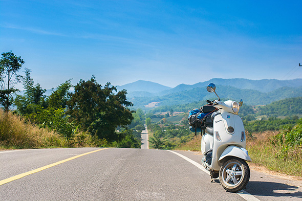

The real thing is much more beautiful than the picture. If you come by car, I recommend driving slowly and opening the windows to take a look. When I arrived at Khlong Lan District, I stopped by to see my high school friend first.

After finishing our conversation, I headed straight to Mae Wong National Park. Upon reaching the toll booth, I paid the necessary fees and proceeded to register with the park officials. As I was doing so, I noticed a sign that read...

(After registering, I drove straight to the cold channel. For those who are going, be careful because it is very dangerous. The park officials will warn us frequently, so listen to them. Along the way in the park, there are many beautiful viewpoints where you can park and take pictures, and there are also points where you cannot park.)
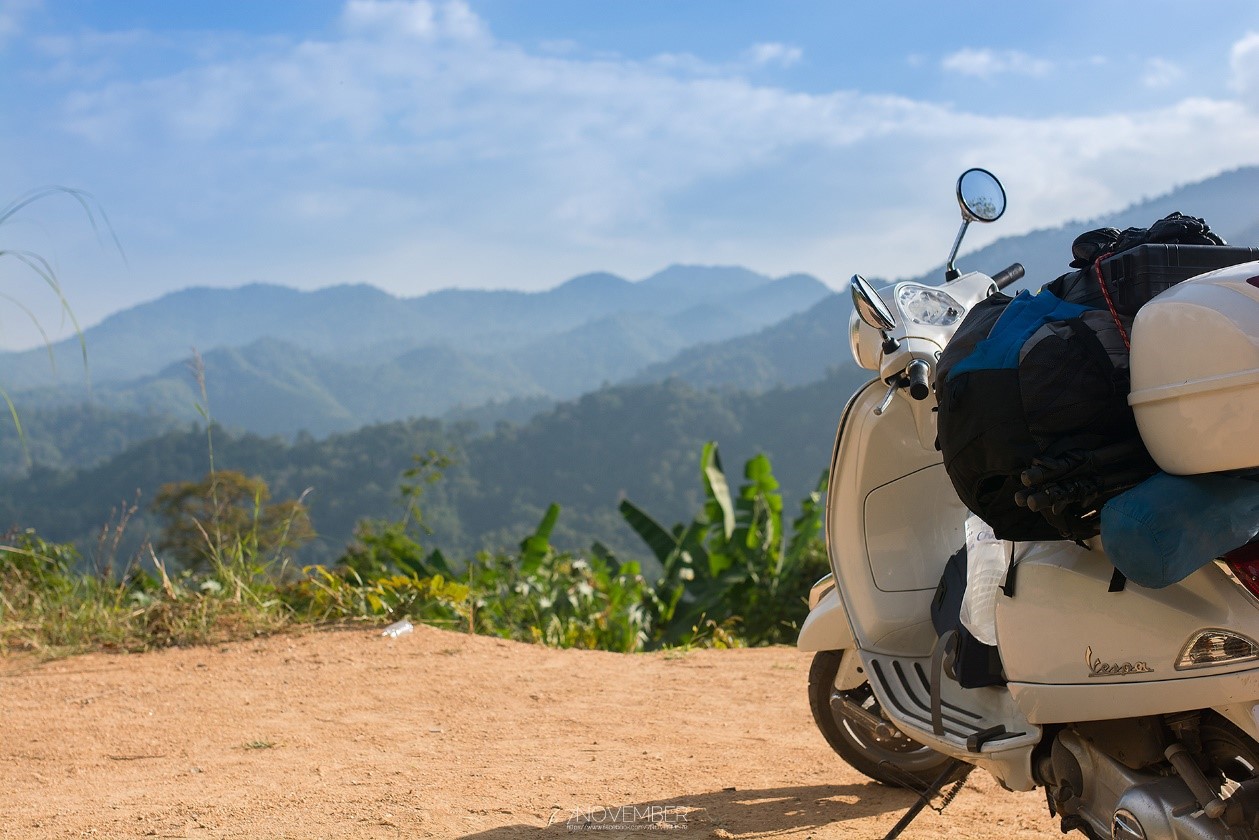

The weather was perfect, not too cold, and finally, I reached my destination.

And then, as usual, I set up my tent and took care of myself, then went looking for more photo opportunities. The officer told me that there was a place he recommended, about 300 meters to the side, but it was another 300 meters of a steep climb. It was very steep, but I managed it. (If you're here, you have to go all the way, or else you shouldn't come at all.) The photos I got are below. (Some of them may have black spots because that's dust on the camera lens, so I'll continue.) At first, I was going to sleep...
From the top, right? When I climbed to the top of something, the staff recommended it.

This image is halfway there, and the other half will reach the top. This time it's like walking up stairs all the way, I want to walk down.
Despite the challenges, they persevered, determined to see it through to the end. And finally, they...

We have reached the peak, my friend! It's called Phusawan, and it offers breathtaking 360-degree views. The scenery here is truly magnificent.

After sitting still and watching the sun slowly set, I thought to myself, "My body is exhausted, and I've driven a long way to climb this mountain. What can I do? It's my dream after all."

We had to descend quickly as the sun was about to set. It would have been too dangerous to descend in the dark, as the path was steep and narrow.
Once we reach the bottom, let's take a few more pictures.

The image above shows the campsite after I set up my tent. The park rangers have designated a specific area for photography, where camping is prohibited. The campsite is very organized and tidy. At night, I cooked instant noodles as usual. (Story about eating instant noodles: While I was eating instant noodles, a family arrived. The father, mother, and young child had not yet set up their tent or anything. At first, I watched them set it up, but then I turned on my flashlight and went over to help them. After we finished setting up the tent, they kindly shared some of their food with me. That made me smile, and I said, "Thank you." That was enough to make me happy.) This time, I had a companion to take pictures of the stars with me. Actually, he was there to take pictures of birds. He told me a lot of interesting stories (different ages but the same heart). After talking to him, I went to bed because I was tired from riding my motorcycle all day.
Note: I'm going to sleep now. I have to wake up early tomorrow. ^ ^ 27 Dec 2014
Waking up to a beautiful sunrise, but unfortunately, I wasn't able to capture it on camera. 555555

In this situation, I decided to boil some hot water and make myself a cup of coffee. I then packed my things and waited to take photos of birds with my friend. (On that day, the park rangers would allow visitors to enter in shifts due to the high volume of traffic. Therefore, we had to take turns going up and down the mountain.) My friend was already setting up his camera to photograph the birds. This time, there was also a foreigner who joined us. ^^(The person on the left is the foreigner.)


Did you see the bird? It flew away, haha ^_^

White-cheeked laughingthrush (apologies, it was out of focus for a moment and then it flew away. This photo is really not good).

A family of burnt-brown cicadas.


The first stop was for photos, as no one was home. The next stop was a much-talked-about gravel pit with water the color of an emerald.

From the 28th to the 29th, I went on a trip with friends to Khao Kho, but I left my motorcycle at home and took a car instead. Here are some pictures to share with you.

We reached the scenic viewpoint. I didn't take many photos during my trip to Khao Kho, as I mostly spent time with my friends.


After a trip to Khao Kho with friends, I returned home. From December 30, 2014 to January 3, 2015, I stayed at home and did not go anywhere. I spent time with my family.
We will continue our journey in the next section.
Thank you all for mistakenly reading our crappy thread. Haha ^^ Now let's continue.
January 4, 2015
Embarking on a Journey to the Mon Bridge
Setting off on another adventure, this time with the Mon Bridge in Sangkhla Buri District, Kanchanaburi Province, as my destination. The distance was considerable, so I left my home in Kamphaeng Phet around 12:20 PM and drove straight through. I only stopped briefly to refuel, fearing I might arrive after dark. I managed to capture a single photograph before sunset, but as soon as the sun dipped below the horizon, darkness enveloped the landscape.

As the sun sets, everything returns home.

The buffalo owner is leading the buffalo into the house, so I stopped to take a picture. Today, I spent most of my time riding a motorcycle. Then, I rushed to Sangkhla Buri. The scenery along the way was beautiful (especially the sunset near the dam, the water was orange). However, I couldn't stop to take pictures because it was getting dark and dangerous. In my haste, I almost fell while going downhill. It was very dark, and I almost didn't make it to tell the story. I arrived in Sangkhla Buri around 8:00 p.m. Upon arrival, I immediately looked for accommodation and found a room at an affordable price. It was a decent place to sleep. Then, I went out to find something to eat at the market. I recommend the 1 baht per skewer pork dipping, which was delicious.
January 5, 2015
Waking up early to offer food to monks at the Mon Bridge. The weather is very cool, around 17 degrees Celsius. Some people are already out fishing.

Then, all that was left was to wait for the sun.

Here it comes!

Please excuse my appearance. These photos were taken and edited haphazardly. I will strive to improve my skills in the future. I apologize for any inconvenience caused.

One more shot, please. Light fog with the sun rising.


In the early morning, some locals go fishing, while others set up stalls at the morning market. I then headed to Wat Badaal, where I hitched a ride with a group of people who were also going there.

From the outside, let's try looking from the inside out.

After returning to my accommodation, I called Thong Pha Phum National Park to inquire about the availability of campsites. I then remembered that I wanted to climb Khao Chang Puak, so I asked the officer if there were any vacancies for the next day (January 6, 2015). The answer was yes (initially, I planned to stay in the area for a night and then return to Bangkok). I was very lucky to have a vacancy, so I told him that I would go. I quickly packed my things and headed to the park. When I arrived, I was shocked! The officer said that my name was not on the list. I was stunned for a moment, but the officer was kind and checked for me. He rode his motorbike back and forth to the phone signal point to add my name to the list. While waiting, I went to the park's viewpoint.

Upon entering, one encounters...the white elephant.

I told myself that tomorrow I must climb the white elephant mountain. Then I looked at the mountain and found a place to sleep for a while.

I waited around the area, thinking that if I couldn't get on the bus, I would pitch a tent and sleep there before returning to Bangkok. After about 20-30 minutes, I went to the tourist service center.
Me: "Brother, will I be able to climb Khao Khang Phek tomorrow?" (And then I got the answer...)
Officer: "Okay… hmm… Now, write down your name and phone number. Then, tomorrow morning around 8:00 AM, meet me in front of the head porter's house. Bring two large bottles of water and enough food for three meals."
"Wow, I finally got on the ride! I'm about to cry. I want to thank my brother so much. (I've always wanted to ride it, but every time I call, it's full. When I come without a reservation, it's not full.)"
We will continue reading to see what happens next. Then, we will tour the E-tong village without delay. The first place we visited was the Elephant Battle Hill, the Thai-Burmese Friendship Channel, the Flagpole Hill, and then back to the Elephant Battle Hill again in order.


The Elephant Tusk Hill is a very high point, not sure if it is the highest, but it offers a panoramic view of the surrounding area. It is also open for camping with restrooms and other amenities. I didn't stay long and moved on to the next destination, which was the Thai-Myanmar Friendship Channel.


A Burmese soldier on duty said "Mingalaba" with a smile and then walked back to Thailand without a trace, as per regulations.

This is the flagpole hill, where the Thai and Burmese flagpoles stand side by side. Then I went to my accommodation to put my belongings away and then went to the Elephant Battle Hill again because I thought it would be nice to watch the sunset there.


Almost falling, change places.


The sun sets over the horizon, and the Teletubbies say goodbye. They enter the village and go to their sleeping quarters to rest up for tomorrow's climb up the White Elephant Mountain. Before settling in, they chat with the head porter about the cost of hiring him. He says it's 30 baht per kilometer. I choose to take only the most essential items, and I'll catch up with you all at the end.
The conclusion can be found at: http://pantip.com/topic/33154186
Thank you very much.
7NOVEMBER
Friday, September 27, 2024 10:24 AM


