
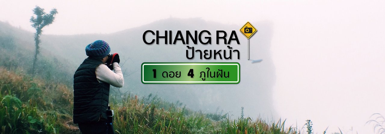


CHIANG RAI Welcome Sign | Lost in the Mist
Chiang Rai ~ 1 Mountain and 4 Dream Hills
**December** marks the start of a new journey, but it's also the final trip of 2016. We've heard whispers that it'll be colder than last year, which has people here wide-eyed. **[It's been a while since we've experienced real cold weather.]** And if you're looking to **"feel the chill,"** then heading **"north"** is the way to go. So, we packed our bags and left home to breathe in the **[mountain]** air, feel the cold wind on our faces, and let the fog embrace us. :)
10 hours | 792.6 kilometers
'Chiang Rai, next stop'
...Just ten hours (Eng) driving straight, you'll get used to it (Hra...aa). The mouse broke, then the snack bag was opened, sitting until the bottom was numb... but still not there. But it was 'worth it' when exchanged for 'the scenery along the way' that cannot be found in the life of a city dweller. Images that gradually change for us to absorb and feel. The atmosphere that begins to fade from the bustling big city to... rice fields, forests and green mountains.
**Chiang Rai Province** boasts numerous hidden gems waiting to be explored. This time, we embark on a journey amidst swirling mist, embracing the crisp mountain air and breathtaking vistas atop the dreamlike peak, our **'ultimate destination'**, beckoning us with open arms.


The first morning in Chiang Rai, at Mae Sai district, the atmosphere changed overnight. The hot and humid air turned into a cool and comfortable one since last night when I arrived at the accommodation. This morning, the cool air is just right, probably around fifteen or sixteen degrees Celsius. My breath is a little foggy, so I can finally use my winter clothes [which are usually buried at the bottom of the closet] and scarf to their full potential. I'm in a hurry, because... I'm afraid I won't get to use them. 55
After breakfast, check out of the accommodation located at the foot of the mountain for convenience when going up to Wat Phra That Doi Tung. The mission is to worship the Buddha and ask for blessings on the occasion of entering the new year.
"He, We, and (Burma) Neighbors"
DOI#1 Doi Chang Moob | Chiang Rai
**: : Doi Chang Moob Viewpoint** is located near **Doi Tung Temple** and **Doi Tung Royal Villa**. It takes only a 9-kilometer drive, approximately 15 minutes, to reach the viewpoint from the temple and villa.
Here, at the **Doi Chang Moob viewpoint** or **Doi Chang Moob base of operations**, located close to the **Thai-Myanmar border**, you can see the **Myanmar flag** fluttering in the distance.
This is a scenic viewpoint offering breathtaking panoramic mountain views. Situated at an elevation of approximately 1,485 meters above sea level, it is located within the compound of the 2nd Cavalry Regiment. Remnants of bunkers used during the turbulent times along the Thai border can still be seen in the vicinity. While I have visited Doi Tung Temple on numerous occasions, this is my first encounter with Doi Chang Moob. If you find yourself at the Doi Tung Royal Villa and have explored the flower gardens, consider making a detour to witness the majestic beauty of this mountain.
~ **Doi Chang Moob Viewpoint** is located within the 2nd Cavalry Company, 3rd Cavalry Regiment Task Force, Doi Chang Moob Base of Operations, Moo 10, Pong Ngam Subdistrict, Mae Sai District, Chiang Rai Province.
Coordinates: 20.338722, 99.812358
~ Getting there: Take the Mae Sai-Doi Tung new road until you reach the Phra Tamnak and Flower Garden intersection. Turn right towards the Mae Fah Luang Doi Chang Moob National Park. Drive straight for 1 kilometer and you will arrive. You can drive up and park your car at the sign in front. Walk up the stairs a little further and the viewpoint will be at the top.


The tranquility of the uncrowded environment is a major draw. A short climb reveals a charming little coffee nook with incredibly relaxing seating. The atmosphere is simply perfect at this moment, allowing the mind to wander while sipping warm coffee brewed by the soldiers on the mountain. The fresh air and gentle breeze create a sense of serenity, allowing time to slow down. It's an indescribable feeling of pure bliss. ❤️ ❤️ ❤️
This location offers a designated camping area, but campers must bring their own tents and supplies. Whether you're looking to catch the sunrise or sunset, or simply spend the night stargazing, this spot is ideal. While amenities are limited, they are sufficient for basic needs. Restrooms are available, along with a small cafe offering hot beverages and light snacks. However, it's important to note that meals must be self-catered.


After descending from Doi Chang Moob, we arrived in Chiang Rai city at noon. We decided to grab a bite to eat before continuing our drive up the mountain. Our destination was the **Thap Tao sub-district**, also known as **"Phu Chi Fa"**, located in **Thoeng District**. The journey was approximately 108 kilometers and took about 2 hours.
The name "Doi Pha Mon" might not ring a bell, but "Phu Chi Fa" will surely spark recognition. "Phu Chi Fa" is a well-known tourist destination situated atop Doi Pha Mon, a mountain range that serves as a natural border between Thailand and Laos, specifically the provinces of Chiang Rai and Phayao.
Let's leave everything behind and embark on a journey to find happiness at the peak of the mountain.
~ The Journey The road conditions vary from smooth to...potholes, with driving ranging from smooth and comfortable to requiring caution due to steep, narrow, and winding sections. The mountain roads are full of sharp turns and S-curves, offering thrilling experiences and breathtaking views. The valleys and [mountains] provide constant companionship along the way (offering a sense of security). Leaving the city, we take Highway 1020 and head towards Teang District. We then turn onto Highway 1021, followed by Highway 1055, and make a sharp right turn onto Highway 1093 to reach our accommodation near Phu Chi Fa.
This path is accessible by both motorcycles and cars, but it requires skillful driving due to the continuous curves. 🏍️ 🚗


"Dream Mountain, Heaven in the Mist"
Aiming to arrive at our accommodation before 6 pm, we opted for a slightly longer but more comfortable route. We turned off at Ban Pang Ka onto Highway 1155, passing through villages and schools to keep us company. We drove past Ban Rak Pha Din and Ban Pha Din Thong, enjoying the long mountain views before making a sharp right turn. After a short drive along the mountainside, we reached our destination.
PHU#1 Phusawan Resort | Chiang Rai
: : Phusawan Resort (Phu Chi Fa) This is clearly a 'heaven in the mist' for those who have been driving around 'the mountain' for more than 2 hours like us :)
The initial atmosphere was undeniably 'right', and it would only intensify as the morning light arrived. Today, the sun had already retreated behind the mountain peaks by the time we arrived, leaving only a faint glow in its wake.


Phusawan Resort (Phu Chi Fa) is a resort located on the hillside of Ban Ta Ba, offering stunning panoramic views. The resort's prime location eliminates the need for strenuous hikes or climbs, allowing guests to enjoy breathtaking vistas from the comfort of their accommodations.
The hosts are kind and friendly, and they provide excellent care for the crabs. The accommodation includes breakfast and dinner, which are served until you are full. The menu is simple and ordinary, but it is surprisingly delicious. The best part is that the food is freshly prepared and served hot from the kitchen. The vegetables are fresh, and the meal is finished with seasonal fruits.
The highlight is here! Coffee lovers will be delighted because the coffee beans here are homegrown and roasted by hand. The farm is located around the accommodation. Each cup is therefore strong and satisfying. There is a hot water, tea and coffee corner at the counter, which is available for self-service 24 hours a day. Oh! There is also Wifi signal here. :)
~ Key Feature: The accommodation boasts stunning views from the front of the house, overlooking rolling hills and a vast sky. On clear days, guests can step outside and breathe in the fresh air while gazing into the distance. They can also enjoy the sunset from the front of the house, or, on cloudy days, watch the mesmerizing flow of the sea of mist.
~ The accommodation Phu Suan Wan Resort (Phu Chi Fa) is located at 44 Moo 19, Rom Po Thong Village, Tab Tao Subdistrict, Thoeng District, Chiang Rai Province | Coordinates 19.806924, 100.435356


PHU CHEE DAO | CHIANG RAI
: : Phu Chi Dao ⭐️ Chiang Rai At the crack of dawn, we set off for the farthest point first, setting our alarms for 4:00 AM. Once we were ready and our cameras were packed, we set off for the trailhead of Phu Chi Dao at 4:30 AM in a pickup truck driven by the resort owner. We had to navigate through the darkness, navigating the narrow, steep mountain roads along the shoulder for a considerable distance. After about 20 kilometers, we reached the base of the mountain, where there was a restaurant, accommodation, and a parking area for the pickup trucks that were lined up waiting to take us to the top. The trail from the parking lot to the top is about 3 kilometers long and quite challenging, requiring a pickup truck or a 4WD vehicle driven by someone familiar with the terrain. We recommend using local transportation for safety reasons and to support the community's income.
The round-trip transportation cost from Phu Suan Saen to the starting point of Phu Chi Dao is approximately 100 baht per person. The journey takes about 25 minutes.
The round-trip transportation cost from the foot of the mountain to the top of 'Phu Chi Dao' [distance 3 kilometers ~ 15 minutes] is 100 baht per person. [If there are less than 5 people, the fare is 500 baht per car.]
Coordinates: 19.877651, 100.444594
...The three-kilometer journey required us to hold on tight to avoid being thrown to the back of the pickup truck, which would have been inconvenient for the passengers in the back. The bumpy ride made us tense, almost to the point of cramps. We forgot about the cold as we focused on driving uphill. After a long while, we reached the top, a wide dirt field with parking spaces and small stalls selling hot drinks, bottled water, and porridge. There were also restrooms available. We took care of our personal needs here before continuing on foot for about 200 meters. As darkness still lingered, we used flashlights to guide our way. We weren't alone, as the group who had ridden in the pickup truck with us joined us on the walk. We walked and walked and walked... until we reached our destination. The 200-meter distance wasn't too far, but the path consisted of high, steep, and slippery earthen steps with wooden railings at intervals. So, there was no need to rush. :)
...We walked and rested, following the path with the sound and light of the headlights. At around 5:00 AM, almost 6:00 AM, before dawn, we reached the kilometer marker indicating the border, which was located on a narrow ridge where only two people could pass each other. When we were in an open area, we looked around and everything had changed. It was no longer a dense forest, but a white expanse. The thick fog that floated above the treetops covered everything below, so that only a small light could be seen faintly in the distance...


'The most liked' is the feeling of 'arrival'.
Standing here, it feels as if... every element of this place belongs to us for a moment. A moment where the mind is clear, unburdened, and one can truly feel the meaning of 'freedom'. Up here... it's truly boundless beauty. :)
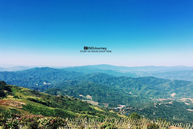
As you walk along the wooden fence that stretches to the end, there is the peak of the mountain, the highest point of 'Phu Chi Dao', a point where nothing obstructs the visual landscape. Surrounded by white clusters that at close range seem to be within reach...it flutters away with the wind. We are at the peak of Phu Chi Dao, at an altitude of about 1,760 meters above sea level. The pointed end of the mountain juts out, allowing for a 360-degree panoramic view.
...Despite the intensifying wind and cold, the photographers continued to click their shutters with unbridled enthusiasm. The air was filled with a fine mist, and the frost, like tiny crystals, clung to the blades of grass, hats, jackets, and even our eyelashes. After a long break, the white sky gradually brightened, taking its time. Meanwhile, the number of tourists steadily increased.
The peak of 'Phu Chi Dao' marks the border between Thailand and Laos, with a wooden fence and stairs leading down to a small, jutting cliff. The two sides of the ridge experience contrasting weather conditions. On the side believed to be Thailand, thick fog rolls in, resembling a waterfall cascading down below. Strong winds occasionally clear the fog, offering glimpses of the valley. On the other side, presumed to be Laos, the fog remains dense and motionless, as if everything is frozen in time. Only faint blue streaks of light stretch across the horizon before fading into the sky.
Time passes... still no sign of the blazing orange sun. Today, the weather is overcast, with only swirling mist to keep us entertained. It seems like we're in for disappointment, but not at all! Not even a little! Just standing here, that word never crossed my mind.


Descending to the ground floor at 8 am, the coldness was palpable, with the driver warming himself by the fire. This time, I used my arm strength to hold onto the iron railing to prevent myself from falling forward. We then boarded the resort's vehicle to return to our accommodation. Throughout the journey back, fog blanketed the surroundings, shrouding the grass and road surface. The dim atmosphere made it almost impossible to see the path, especially when passing through the mountain ravines. The area near the ascent to 'Phu Chi Fa' was where the mist cascaded down overwhelmingly.
This morning at 'Phu Suan Swan Resort' is no less beautiful, the weather is cool and comfortable since early morning. There is mist floating to tease the mountain peaks to the front of the house in waves. Today, the weather is closed because it rained last night, causing the fog to descend quite heavily this morning. Covering the mountains and coming to fill it up, it's good for the elderly who are not convenient to go and fight. Walk to see the sea of mist to the top of the mountain because the view here is magnificent. Plus, it's 'fin' to sit and sip fragrant coffee, eat soft patongo [resort recipe] that is served to the front of the house.
We arrived back at our accommodation famished, thankfully the table was already set for us. We started by sipping hot tea while we waited. Soon, a large pot of rice porridge was served at the table, along with a variety of side dishes. Freshly brewed strong coffee was also served. Everything was... delicious. :)


The day was shrouded in mist, which hung heavy over the accommodation and spilled onto the road below. In the late afternoon, we set out to explore the area, heading towards Doi Pha Tang. The road was winding and hilly, with a mix of good and bad stretches, but the views were stunning.
This route passes by the ascent to 'Phu Chi Fa' and 'Phu Chi Dao' respectively, and also by the ascent to 'Phu Chi Fa' on the Wiang Kaen district side, where the 'Hngaw-Ngow Headwaters Management Unit' is located. I tried driving in to survey the route. The entire ascent was shrouded in mist and dew. I drove through the mist on a small road lined with [unbloomed] tiger lily trees. Reaching the top, we had to continue on foot for about 400 meters. The weather was not suitable for climbing the mountain, so we turned back down. We passed through a village with several accommodation options, offering another alternative for those who want to climb 'Phu Chi Fa'.


… and continued on to Pha Tang House, located at the foot of Doi Pha Tang, a renowned viewpoint for admiring the mist-shrouded mountains. However, due to unfavorable weather conditions, we were unable to ascend to the peak. Instead, we enjoyed the scenic route and stopped at 'Pha Suk Restaurant', a long-standing Yunnan Chinese eatery on Doi Pha Tang. We sipped tea and savored tender pork leg with warm mantou, relishing the delightful experience amidst the cool ten-degree weather.
Pha Suk Restaurant: A Mountain View Delight
Pha Suk Restaurant, with its open-air design and refreshing breeze, offers a unique dining experience. The cool air can be felt even on the hottest days, making it a welcome respite from the sun. While the hot tea cools down quickly, the breathtaking mountain views from the back balcony more than compensate. The food is tasty and reasonably priced, making it a perfect stop for anyone visiting the Pha Tang area.
~ **Pha Suk Restaurant** is located in Ban Pha Tang, Wiang Kaen District, Chiang Rai Province | Coordinates: 19.930187, 100.508057


PHU CHEE FA | CHIANG RAI
: : Phu Chi Fa In The Mist 'Phu Chi Fa' remains a landmark of this area, a well-known viewpoint for the sea of mist on Doi Pha Mon. Therefore, it is a must-visit even if you have been here once before. 'Phu Chi Fa' is a mountain peak located at the Thai-Lao border, with a cliff that juts out, standing at an altitude of approximately 1,628 meters above sea level.
On the second day, we woke up before 4:30 am and took a car to the starting point of the hike to Phu Chi Fa on the side of Ban Tab Tao, which was about 10 kilometers away. [The resort provided transportation.] We then hiked for about 760 meters. The trail was quite slippery but not too steep. It was a bit dark, but not as dark as the previous day, and there were many people hiking up. It was lively with both tourists and local children in colorful hill tribe clothing, who were dancing along the way. If you were tired, you could take a break and watch the children.
Round-trip transportation from 'Phu Suan' to the entrance of 'Phu Chi Fa' costs 80 baht per person. | Coordinates: 19.858628, 100.454103
The photographers were eager to find a spot and set up their cameras. The morning air was not much different from yesterday's, and the fog seemed even thicker and more widespread. People gathered on the promontory above, which could accommodate dozens, and some continued to the very top. We set up camp further down to capture the promontory against the backdrop of Phu Chi Fa. However, the mountain remained shrouded in fog until it gradually cleared, revealing only a faint outline of Phu Chi Fa. Oh well, that's just the way nature is, isn't it?
**Immerse yourself in the ethereal beauty of Phu Chee Fa...In The Mist.** The captivating landscape transforms into a mesmerizing spectacle, shrouded in a veil of mist. 😊 😊 😊


Descending the mountain at eight o'clock, I encountered this young couple at the foot of the mountain. [Took a picture and gave them a scholarship.] It was late, and the battery was low, so I could only pose for a cool photo together. :)
The parking lot below is full of cars waiting. If you're hungry, just walk into the shop. There are many things for sale, including hot roti. There are also shops selling hill tribe clothes and souvenirs to keep you entertained while you wait for the resort car to pick you up.


...Upon arriving at the accommodation, we had breakfast and packed our belongings to continue our journey.
This trip started from Chiang Rai Province to Amphoe Thoeng (Phu Chi Fa) and will end in Nan Province, the city of love. We took the route from Amphoe Thoeng to Amphoe Chiang Kham, a long drive with few houses. Small cars can drive on this route, and it is recommended to fill up your gas tank beforehand as gas stations are scarce. Before reaching our destination, we stumbled upon this place by chance... the 'mountain', the 4th of our trip. :)
PHU SANG | PHA YAO
PHU#4
**: : Phusang Waterfall** is located within **Phusang National Park, Phayao Province**, on the Doi Pha Mon mountain range. It is an **UNSEEN** destination because it is the only warm waterfall in Thailand. The water temperature is around 35-36 degrees Celsius. The warm pool has an emerald green color and visitors can soak in the waterfall. The surrounding area is shady and a humid rainforest, creating a cool and comfortable atmosphere. It is an ideal place to rest after a long drive. Stop by! What are you waiting for? Park your car on the opposite side and cross the road to the waterfall side.
~ Parking fee 30 baht per car.
~ Directions: Take Highway 1093 from Chiang Rai to Thoeng District, towards Chiang Kham District. The Tourist Service Center will be located on the side of the road (with restrooms). | Coordinates: 19.663660, 100.376007


"Our journey... is not over yet."
This MINDJOURNEY ROAD TRIP took 5 nights and 6 days. We spent 3 nights in Chiang Rai Province, embracing the mountains and getting lost in the mist on the mountaintops. But our journey continues.
Departing from Phu Sang Waterfall, we embarked on a three-hour journey to reach Chiang Klang, a dream destination for many. Stay tuned for the [next chapter] of our adventure in our upcoming review.
Today...thank you for joining us on this journey. 😊 😊 😊
------------------------------------------------------------------------------------------------------------------------------------------------
: : Read the travelogue 'MINDJourney | Story of Khon Chop Tiew' here (click) : :
Escape to the Sea: A Review of Thavorn Palm Beach Resort Phuket
This article explores the Thavorn Palm Beach Resort Phuket, offering a glimpse into its offerings and potential as a relaxing escape.
MEMORIES at TRANG | Travel, Explore, Cruise...Trang
"Phuket" invites you to fall in love with food.
PHUKET Street Art | Must-See Art | 8 Graffiti Check-in Points in Phuket
Green Space in the City | TOWN TREE by Coffee Tripper
Wang Nam Khiao Trip | Enjoying Ozone Land
Coffee Tripper | 'Escape the Heat' and Relax at...WOOD Cafe'
Chanthaburi Trip | When I accidentally fell in love with 'Chan'
Stay Alive!! Island Hopping Adventure: Exploring the Andaman Sea, Phuket, and Krabi
Sapa, the city that made us fall in love with 'him' Part 1 | Vietnam Trip: Ha Noi - Sapa EP#1
Sapa: The City That Made Us Fall in Love with "Mountains" - Part 2 | Vietnam Trip: Hanoi - Sapa EP#2
Sapa, the city that made us fall in love with 'him' Part 3 | Vietnam Trip: Ha Noi - Sapa EP#3
: : If you share our passion for travel, join us in sharing and discussing travel experiences on our Facebook page, 'MINDJourney | Story of Khon Chop Tiew'. : :

Roam with Joy in My Company


GO OUT THERE
Friday, October 4, 2024 3:08 PM