


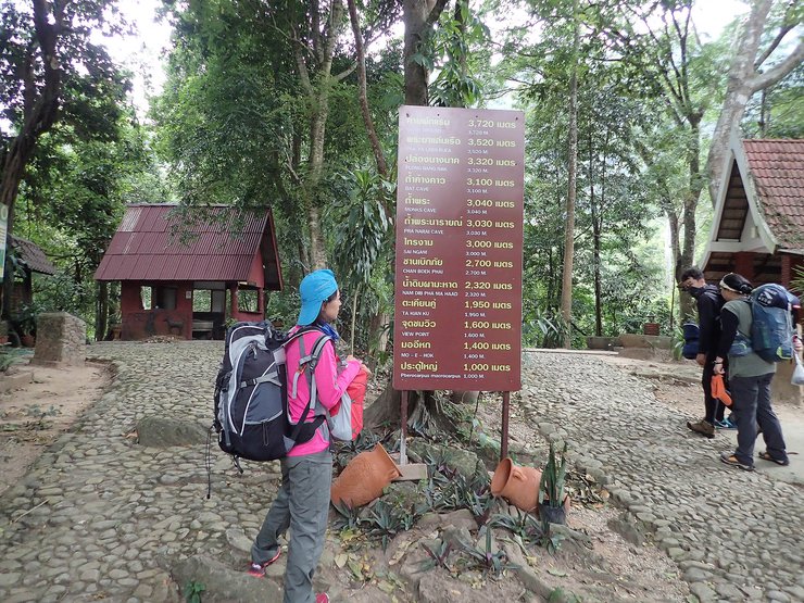
Many people say that hiking Khao Luang in Sukhothai is a challenging route. Is this true? Let's find out.
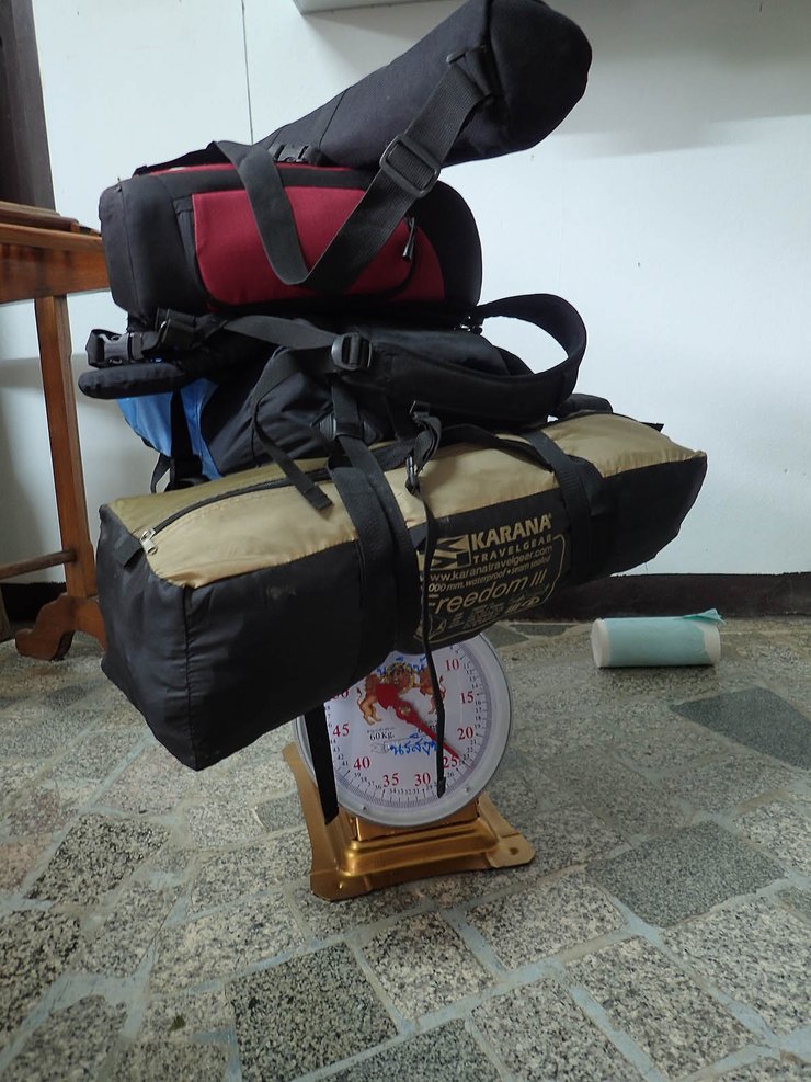
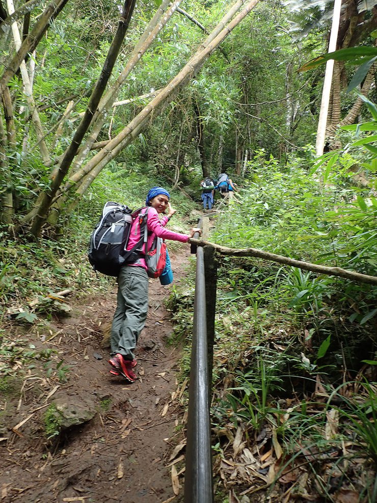
Our journey took us through Nakhon Sawan and Kamphaeng Phet, before we finally reached Ramkhamhaeng National Park at 8:15 AM. However, due to the long holiday weekend and our late arrival, we found that 300 people had already arrived and filled up the park's tents. The only options remaining were blankets and porters who had not yet arrived. This meant that we had to carry all our belongings and tents ourselves, which weighed a total of 24 kg. It was a close call, and we almost turned back home.

Let's meet up sometime. We'll get there eventually.


We started our journey at 9:30 am. The walk was steep, about 45 degrees, but not too long. After a while, we reached a viewpoint. We thought we had come a long way, but it was only 1 km out of 3.5 km. So, we continued our journey.

No text provided for translation.

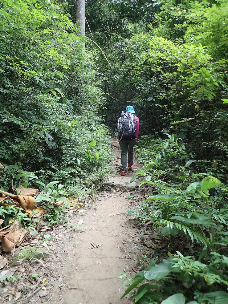
This section of the trail is arguably the steepest, as it is not only inclined but also lacks rest stops until reaching the Siamese twin takien trees.
After the twin takian trees, the porters said the walk was easier. While it was indeed more comfortable than the previous sections, it was still an uphill climb. The last water source before the park headquarters is at the Pha Ma Had raw water point.
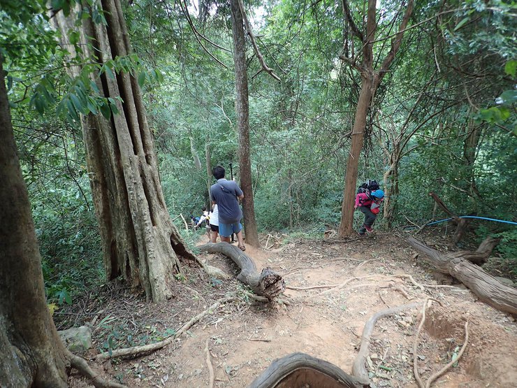
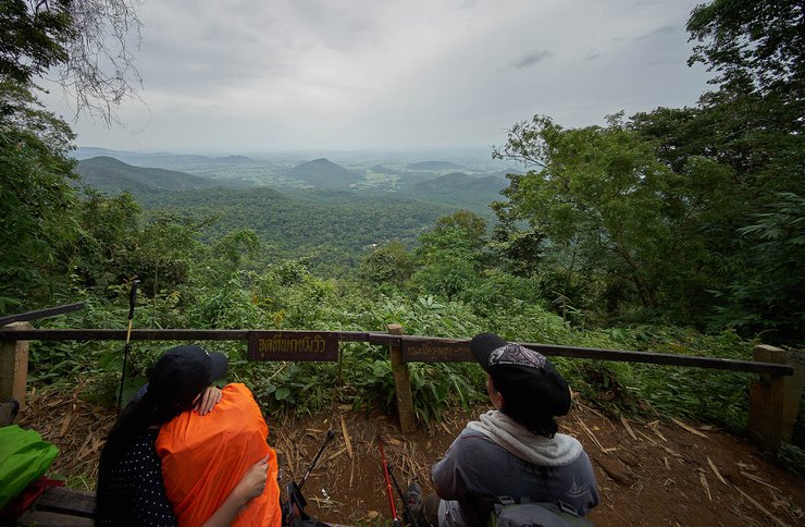
The next point is the beautiful bra. It's a comfortable walk compared to the previous one.


From the beautiful viewpoint, it's not far (as they say). Walking steadily, it won't take long to reach Phraya Laen Reu. Then, just one more hill to reach the campsite.

The provided text is empty. There is nothing to translate.
A 3.5 km walk that took 3 hours.
At the campsite, only instant noodles and hot water are available for purchase. However, it is recommended to bring your own food during peak season as supplies may run out. Water can be refilled from the tap, which I have personally tested and found to be safe.

After setting up our tents and taking a short break, we decided to go for a walk to the nearby Mae Ya peak, which was about 1 kilometer away. However, as we started walking, it began to rain. We ended up walking in the rain the entire way to the peak. When we reached the top, we were surrounded by rain and wind, so we decided to continue walking in a loop to complete the circuit. This took us past Chedi Hill and eventually led us back to the restrooms near our campsite.


The night we went, the wind was very strong, so much so that the tent flapped all night. However, we fell asleep due to exhaustion. When we woke up early the next morning, we rushed to see the sunrise at the top of Narai Mountain. But because of the storm, all we saw were clouds. We missed seeing the sunrise again.
Only the light from Sukhothai city was visible.

A large crowd has gathered to watch the Argentina national football team.


We returned for breakfast and then started walking again, aiming for Phu Ka. The first stop was Tham Mahe-rok Cave. We walked down a short distance and reached a cliff-like promontory where there was a Buddha statue for us to worship.

The next stop is the top of the pagoda. When we arrived, the clouds were just passing by. It was a pity that we couldn't find an angle to take a picture because we had to walk a little further. There was a slight regret. From the pagoda, we found a岔路to Phuka 1 km away.

Geckos in the area of Khao Chedi


The trail was easy to navigate, but there was a steep incline towards the end. We encountered many clouds, but fortunately, the sky cleared, allowing us to see far into the distance.


There is no text to translate.

There is no text to translate in the provided input. Please provide the text you would like me to translate.


The sentence is already in English and does not require translation.
From the mountain, we had to walk back to the fork in the road and then climb the hill to Mae Ya. However, we encountered thick white clouds because the peak of Mae Ya is so high that it reaches the clouds.
We then continued walking to Pha Chomprong, where we were fortunate enough to experience a break in the clouds. We decided to stay and watch the sunset at Pha Chomprong before returning to our campsite.

However, when we arrived at the campsite, we were met with a heavy downpour and were forced to stay in our tents. As evening approached, the rain stopped, and we ventured out to Pha Chomprong, but once again, we were met with thick white clouds, and we had to return to our tents.

No text provided for translation.

I went to see the sunrise again at Pha Narai, but the sky was not cooperative as before.


The descent was ultimately unavoidable. The downhill journey was relatively quick, taking only two hours, but it was a knee-jarring experience.

There are some flowers to admire along the way.

Along the roadside near Chan Beik Pai, ferns are a common sight.

This is a downward trend. See, even with this much weight on its back, it can still go up. So, it's a breeze.


The trail is well-maintained and offers water at intervals. However, the incline is quite steep, approximately 24%. In comparison, the incline of Phu Kradueng is only 21% (calculated by dividing the height by the distance).
If you are visiting during a festival, be prepared to bring your own food and drinks, as there may not be many vendors available.
This is a beginner-friendly hike (no need to carry luggage), but some preparation is recommended as the trail is quite steep.
The 4 km summit trail (including the 2 km round trip to Phu Ga) features a challenging uphill and downhill terrain.
It is advisable to check the weather conditions beforehand, as encountering rain could hinder your experience and potentially obscure the scenic sea of fog, leaving you amidst the clouds instead.
Thank you all for watching.


Sinard Narktubtee
Wednesday, February 26, 2025 7:18 PM